AI Wildfire Detection
Early Smoke Recognition, Drone Coverage, and Offline Terrain Monitoring
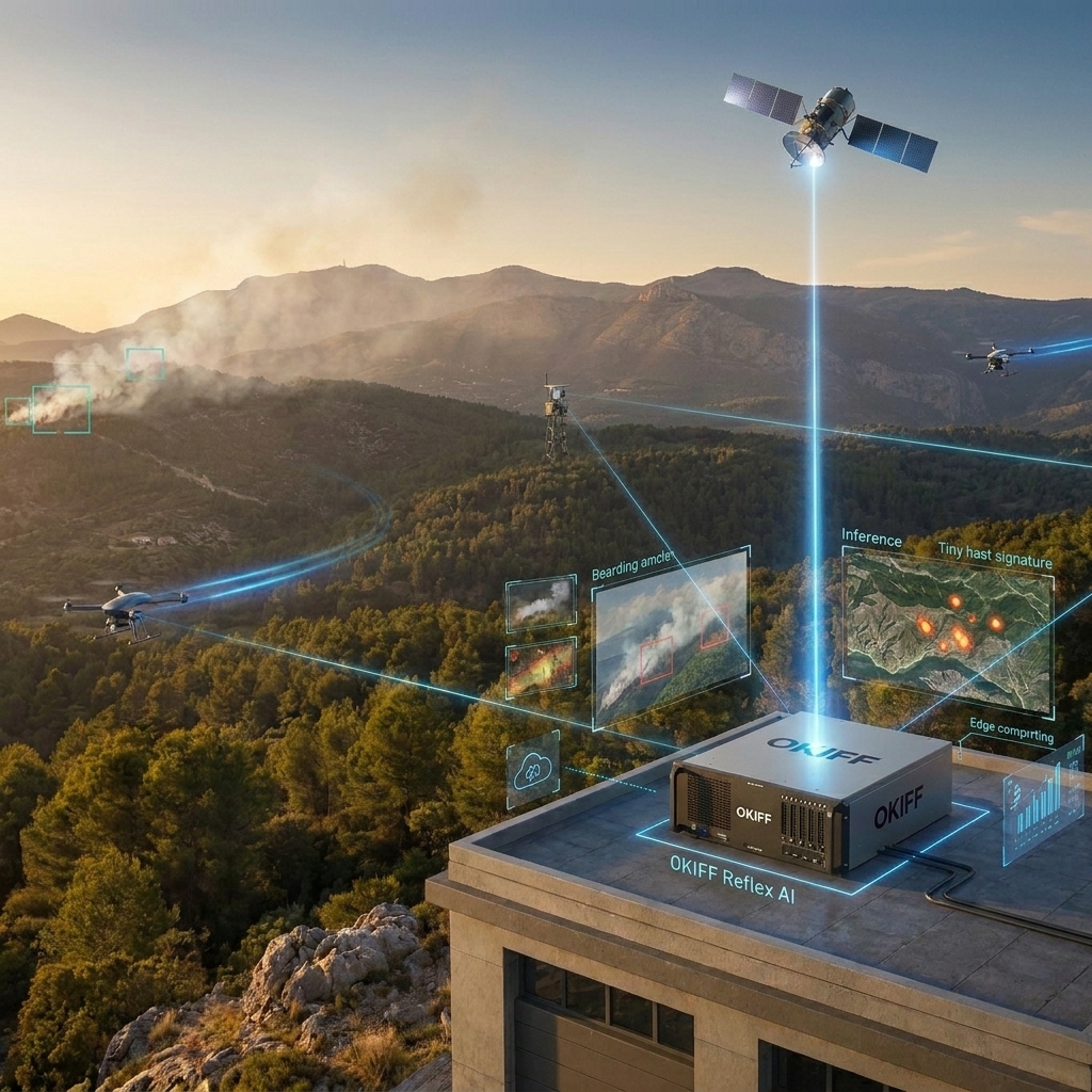
A wildfire's most valuable warning window is also its shortest. Okiff Reflex identifies the visual signature of smoke and fire formation in under 10 milliseconds across vast, camera-sparse terrain — combining fixed camera coverage, drone feeds, and satellite terrain imagery into a single detection and awareness layer that keeps working after the power grid, the cell tower, and the WAN link have already failed. Locally. Sovereignly. Off-grid when it has to be.
< 10ms
AI detection latency for fire and smoke signatures on every feed
100%
Offline operational continuity — no WAN dependency
360°
Coverage — fixed cameras, drone feeds and satellite imagery
Why wildfire detection still arrives after the fire has already taken hold.
A wildfire rarely begins as a wall of flame — it begins as a smoke signature above a tree line, a spark at a transmission fault, a smouldering ignition point in dry vegetation. That window of minutes is the difference between a contained incident and a mass evacuation, and most detection infrastructure isn't built to catch it. Legacy satellite monitoring — downlinking full imagery for ground-side processing — updates on a cycle of roughly 10-15 minutes at best, with alert latency commonly running 30 minutes to two hours: useful for tracking an established fire, too slow for ignition. Human lookouts can't scale across hundreds of kilometres of corridor or forest boundary.
 Cloud-dependent AI carries a harsher risk than usual here
Wildfire disables the exact infrastructure a cloud system needs, as cell towers lose power and fibre backhaul burns. Fixed cameras alone also leave gaps — a ridge without a camera, a gully out of range, a span between substations — exactly where downed lines and lightning strikes most often ignite.
 Okiff Reflex closes all three failures at once
Detection speed, terrain coverage, and survivability when the grid and the network go down.
Okiff Reflex: wildfire intelligence that keeps running when everything around it stops.
Okiff Reflex processes every camera feed, drone stream, and sensor input on a local edge server at the substation, field station, wildland-adjacent site or even in a space satellite — AI inference running continuously, independent of any cloud connection. The moment a smoke plume forms or a sensor threshold is crossed, an alert dispatches in under 10 milliseconds.
Three wildfire-specific capabilities:
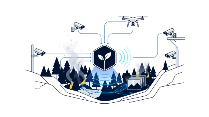
 Early Fire & Smoke Signature Detection
Identifies the visual formation of smoke and flame on every connected camera, day and night, no operator required. Triggers a Rules & Events alert with camera reference, zone location, and a pre-event clip.
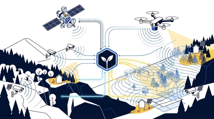
 Drone & Satellite Terrain Extension
Fixed cameras can't economically cover every ridge and gully. Drone feeds ingest via RTSP and vendor SDKs, with the same AI models applied in real time — turning a sweep into an active sensor, not just a recording tool. Satellite imagery extends coverage, giving wide-area vegetation and terrain context that flags high-risk zones and coverage gaps before they become blind ignition points.
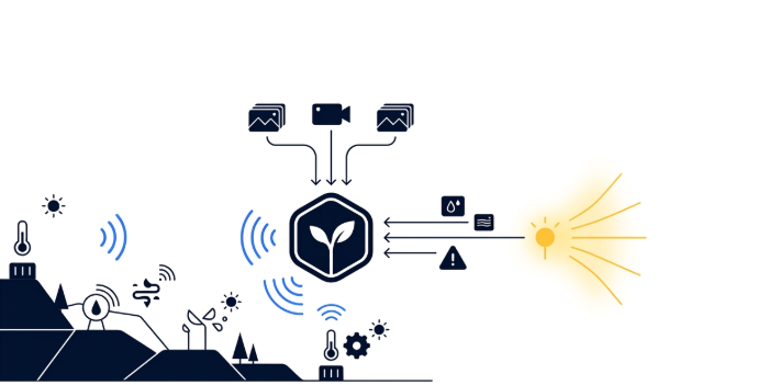
 Environmental Sensor Fusion & Offline Autonomy
Temperature, humidity, and air-quality sensors integrate via LoRa, NB-IoT or LTE-M. Rules & Events correlates a temperature spike with a camera-detected smoke signature to escalate a single anomaly into a confirmed alert. Every capability here — detection, correlation, alerting, recording — keeps running with zero WAN dependency, because a wildfire is exactly the scenario where grid power and connectivity fail first.
What are Okiff's key capabilities?

Fire & Smoke Detection
Continuous AI identification of smoke and flame formation across every connected camera — day and night, no monitoring operator required

Drone feed integration
Real-time AI detection applied to aerial drone streams via RTSP/vendor SDKs — extending coverage across terrain fixed cameras cannot reach

Satellite terrain coverage
Wide-area vegetation and terrain context beyond fixed camera and drone range — extending situational coverage across zones with no ground sensor presence

Smart Zone monitoring
Vegetation and terrain boundaries defined as monitored zones — alerts on any smoke, flame, or unauthorized ignition-risk activity within the zone

Rules & Events multi-agency escalation
A single detection event routes simultaneously to utility operations, municipal emergency services, and forestry management — no manual relay

Offline operation
Full detection, recording, and alerting continues with zero WAN or grid dependency — critical for remote substations and wildland field stations

Edge Storage
AES-256 encrypted, on-premise footage archive — fire progression and pre-ignition footage retained locally, never exposed to external access

Environmental sensor fusion
Long-range LoRa temperature, humidity, and air-quality sensors correlated with camera-based fire detection at the same location

Cross-zone tracking (MTMC)
Maintains a continuous view of fire progression or responder movement across every camera in a transmission corridor or wildland boundary
Wildfire mitigation across the assets most exposed to ignition risk.
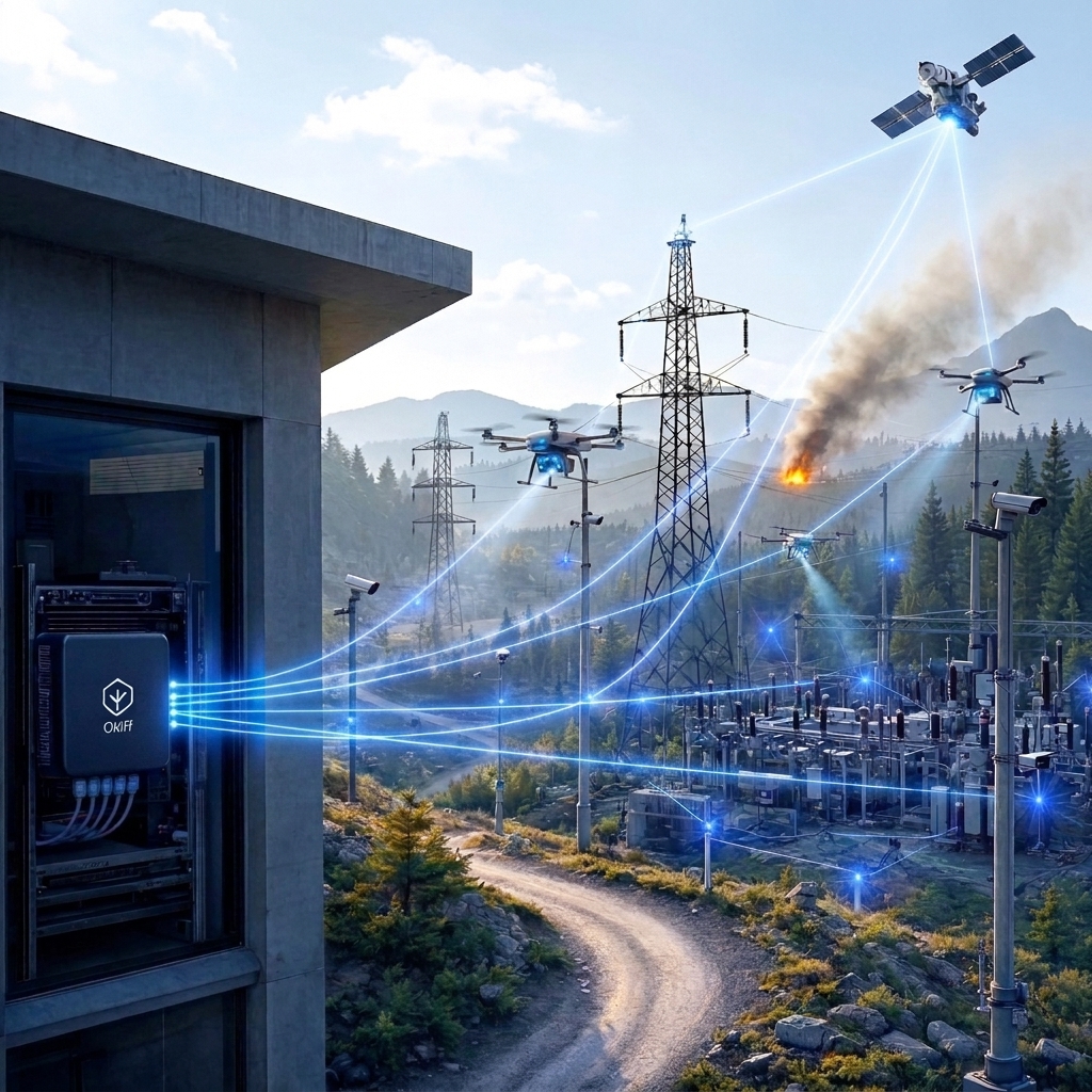
Electrical Utility Transmission Corridor
A utility manages 400km of transmission corridor through high fire-risk terrain, where a line-fault ignition means real liability exposure. Edge nodes at each substation cover line spans, with Smart Zone monitoring flagging vegetation encroachment beneath conductors. A conductor fault producing a spark and smoke signature alerts the operations centre and the regional fire authority simultaneously — span location, pre-event clip, isolation recommendation — before ignition spreads past its origin point.
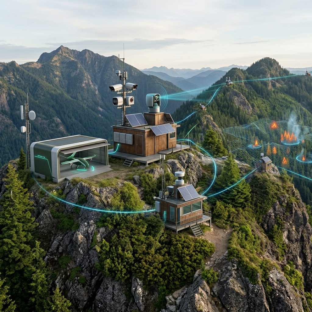
Regional Forestry & Land Management Agency
A forestry agency replaces unmonitored fire-lookout towers with Okiff Reflex nodes across a mountainous district. Drone sweeps during high-risk weather windows feed the same AI detection layer, reaching gullies and ridgelines no fixed camera can cover. Every node runs fully offline given the district's limited cellular coverage, syncing to the regional command centre when connectivity allows.
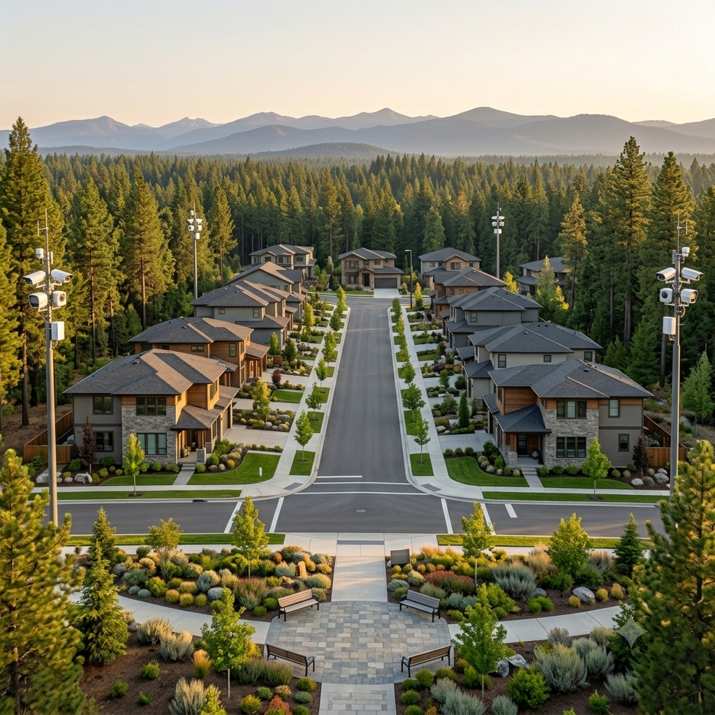
Wildland-Urban Interface (WUI) Residential Portfolio
A real estate group deploys Okiff Reflex across a development's perimeter, correlating Fire & Smoke Detection with tree-line sensors. A confirmed detection triggers property management, the municipal fire service, and an automated resident announcement simultaneously — advance warning ahead of any official evacuation order.
FAQ
How does Okiff Reflex detect a wildfire before it becomes visible to conventional sensors?
Fire & Smoke Detection is an AI model that identifies the visual signature of smoke and flame formation directly from camera and drone footage — an early visible stage of ignition, often preceding the heat buildup needed to trigger a conventional point thermal sensor. Detection runs continuously on every connected feed, with results available in under 10 milliseconds.
Can Okiff Reflex operate in remote wildland areas with no internet or cellular connectivity?
Yes. All AI detection, recording, environmental sensor correlation, and Rules & Events alerting run entirely on the local edge server, with zero dependency on WAN or cellular connectivity — essential for utility substations, forestry field stations, and wildland sites where grid and network infrastructure are frequently the first assets a wildfire disrupts.
Does Okiff Reflex integrate with drones for aerial wildfire surveillance?
Yes. Drone camera feeds are ingested directly via RTSP and supported vendor SDKs, with the same AI detection models — including Fire & Smoke Detection — applying to aerial footage in real time. This extends detection coverage across terrain that fixed camera placement cannot reach economically.
How does Okiff Reflex correlate environmental sensor data with camera-based fire detection?
Temperature, humidity, and air-quality sensors integrate seamlessly. The Rules & Events engine correlates a sensor anomaly — such as a rapid temperature rise — with a camera-detected smoke or flame signature at the same location, escalating the combined pattern to a higher-priority, confirmed alert.
Can Okiff Reflex alert multiple emergency response organizations from a single detection event?
Yes. The Rules & Events engine dispatches a single confirmed detection to multiple destinations simultaneously — utility operations centres, municipal fire and emergency services, forestry management, and property or facility teams — each receiving zone location, camera reference, and a pre-event footage clip, with no manual relay between organizations.
Catch the ignition before it becomes the fire.
Join us and make your company a better place.